
Reviewed · HELICOPTER TOURS
Rotorua: Scenic Flight over Mt Tarawera & Waimangu Valley
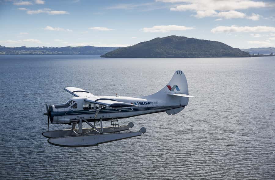
See Rotorua from the water and sky. This short flight combines a floatplane takeoff on Lake Rotorua with sweeping views of 13 lakes, Mount Tarawera, Waimangu Valley, and the city’s famous geothermal areas. I especially like the water takeoff and landing, which give the trip a memorable start and finish, and the direct view into Tarawera’s huge 1886 crater rift. The pilot’s commentary adds useful local context rather than leaving you to guess at the scenery.
The main drawback is the weather. Clouds or poor visibility can shorten the route, change the flight time, or cancel the outing. That is not a minor footnote here, since the point of the flight is seeing volcanic craters and colorful thermal features from above. A January flight had to skip part of the circuit but still went ahead, with a partial refund, so flexibility matters.
In This Review
- The five details that make this flight special
- Starting at Lake Rotorua with a splash
- Climbing past Mokoia Island and Rotorua’s lake country
- Flying directly over Mount Tarawera
- Waimangu Valley from a rare viewpoint
- Returning over Pohutu Geyser and Whakarewarewa
- What the $236 price really buys you
- Weather, comfort, and practical limits
- Who will enjoy this most
- Should you book the Mount Tarawera flight?
- FAQ
- Where does the flight begin?
- How long does the experience last?
- Does the aircraft take off from the water?
- What sights can I see from the plane?
- Will I fly over Mount Tarawera?
- Is there a guide during the flight?
- How large is the group?
- What should I bring?
- Can the flight be canceled because of weather?
- Is the experience suitable for wheelchair users?
The five details that make this flight special
- A real floatplane takeoff: The aircraft lifts directly from Lake Rotorua, giving you a small burst of seaplane excitement before the views begin.
- All passengers get a window seat: This is especially useful for photographing Mount Tarawera, the crater lakes, and Waimangu Valley.
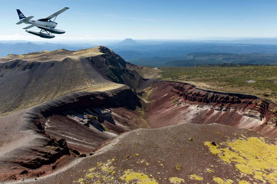
- Mount Tarawera’s 8-kilometer crater rift: You fly over the scar left by the 1886 eruption, one of New Zealand’s most important volcanic events.
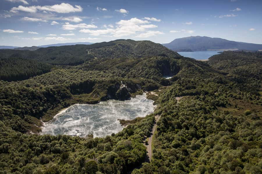
- Waimangu from above: Inferno Crater and Frying Pan Lake appear as vivid volcanic features that are hard to appreciate fully from ground level.
- A compact small-group flight: Groups are limited to 10 people, keeping the aircraft less crowded and the pilot’s commentary easier to follow.
- A changing return route: The flight back includes Whakarewarewa Thermal Valley, Pohutu Geyser, and Rotorua city.
Starting at Lake Rotorua with a splash
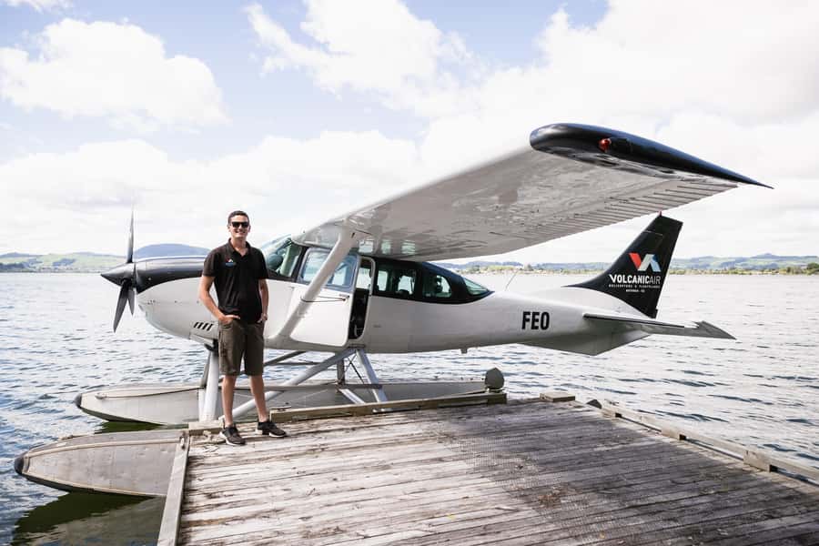
You check in at the Volcanic Air office at 1 Lakefront Drive. Look for the large signs on the roof. The setting is practical and scenic, since you are already beside the lake where the aircraft will take off.
A safety briefing comes first. The published experience lasts 40 minutes, with about 30 minutes of actual flying, although the exact timing can shift with weather, passenger numbers, and volcanic conditions. You should treat the schedule as a guide, not a stopwatch.
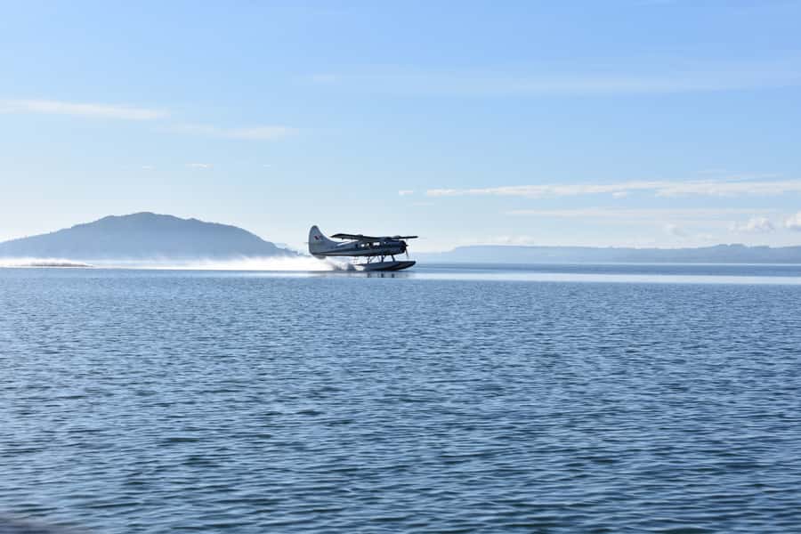
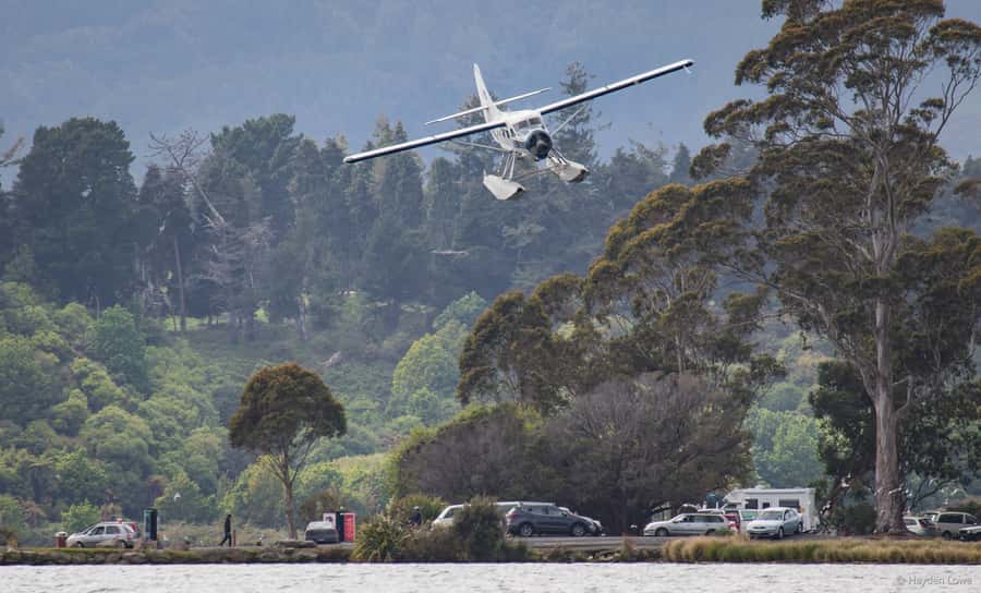
The first thrill is the floatplane run across Lake Rotorua. It is a different start from a normal airport flight: you feel the aircraft move over water before it lifts into the air. For many people, this moment is nearly as memorable as the volcano itself.
The small-group limit of 10 helps. You are not being loaded onto a large sightseeing aircraft, and the flight feels focused on looking outside. A passenger named David specifically praised the smooth takeoff and landing, as well as the fact that every passenger had a window seat. That arrangement matters on a scenic flight, because a middle seat would turn much of the trip into a neck-stretching exercise.
More helicopter flights in Rotorua:
- Mt Tarawera Helicopter Tour with Volcano Landing
★ 5.0 · 40 reviews - Mount Tarawera Volcanic Adventure by Helicopter
★ 5.0 · 11 reviews - Rotorua: Helicopter Flight and Guided Walk on Mt Tarawera
★ 5.0 · 10 reviews
Climbing past Mokoia Island and Rotorua’s lake country
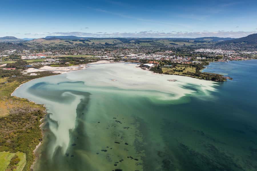
After takeoff, the plane climbs around Mokoia Island and crosses the ridge toward the less visible lakes district. From this height, Rotorua’s setting begins to make sense. Water, native bush, volcanic ridges, and open ground fit together in a way that is difficult to grasp from a road.
The flight offers views of 13 lakes in the wider Rotorua area. You will not study every lake in detail, and the route can change, but the broad view gives you a useful sense of how volcanic activity shaped the region.
This section is also a good reminder of why an aerial trip works well in Rotorua. On the ground, you see one thermal park or one lake at a time. From the aircraft, you can connect them. The lakes are not isolated sights. They form part of a much larger volcanic basin.
Your pilot provides live commentary in English, with an English audio guide also included. The quality of the narration is important on a flight this short. A pleasant view is one thing, but knowing what happened at Mount Tarawera and where the thermal valleys fit into Rotorua’s story gives the trip more weight.
Flying directly over Mount Tarawera
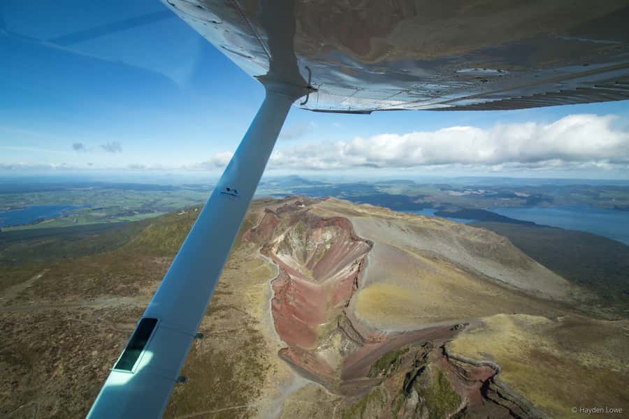
Mount Tarawera is the main event. Rising to 3,680 feet, the dormant volcano has a broad, broken profile that dominates the surrounding area. The aircraft flies over the long crater rift left by the eruption of 1886.
That eruption changed Rotorua forever. It destroyed the famous Pink and White Terraces, once promoted as the eighth wonder of the world, and devastated the surrounding area. From the air, the scale of the crater system becomes much clearer than it does from a single viewpoint on the ground.
The views here are about shape and color. Volcanic craters, exposed rock, and surrounding lakes create strong patterns for photography. Bring a camera, but remember that you cannot bring bags onto the aircraft. Keep your equipment limited and easy to handle.
Mount Tarawera is dormant, not extinct. That distinction is worth understanding, but the flight is not presented as a volcanic expedition. The pilot’s job is to show you the features safely and explain the setting while keeping the aircraft on its approved route.
Cloud cover can make a major difference. When the summit and crater rift are clear, this portion should justify much of the ticket price. If cloud blocks the volcano, the flight may still offer attractive lake and bush views, but it becomes a different experience.
Waimangu Valley from a rare viewpoint
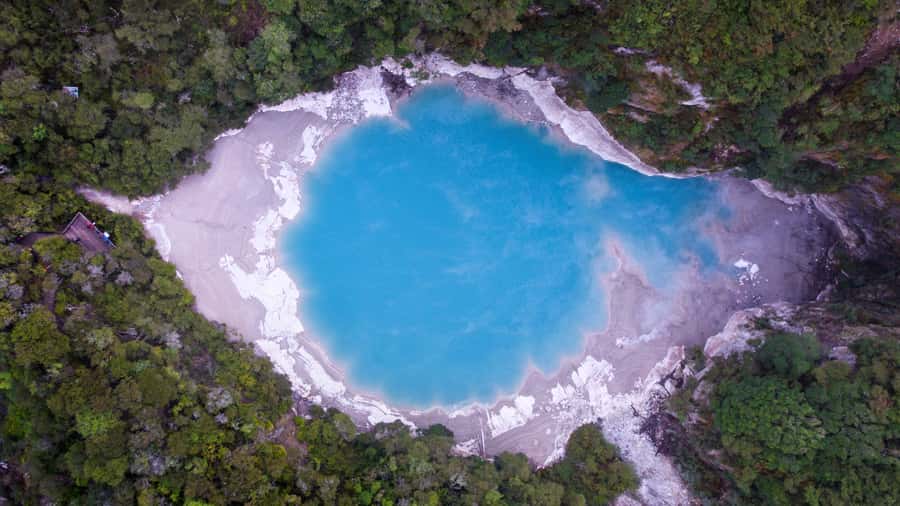
The route continues toward Waimangu Volcanic Valley. From the air, you see the thermal valley and its crater lakes, including Inferno Crater and Frying Pan Lake.
These features are difficult to read from a normal road. The aircraft gives you the wider outline first, then lets you pick out the individual pools and volcanic openings. The effect is less about one dramatic point and more about seeing how heat, water, and old eruptions have shaped the valley.
Waimangu is also a useful contrast with Mount Tarawera. Tarawera gives you the great scar of a major eruption. Waimangu shows a more varied thermal area, with steaming water, crater shapes, and colored surfaces spread through a narrow volcanic zone.
The exact shades will depend on light and weather. Do not expect an aerial view to reproduce the close-up colors you might see while walking through a thermal park. From the plane, you gain scale and pattern, while a ground visit gives you texture, steam, smell, and closer views.
That is why I see this flight as a strong companion to a Rotorua geothermal visit, not a full replacement for one. If you have time for only one short outing, the flight gives you more geographical context. If you have a full day, pairing it with a ground visit makes the two experiences more complete.
A few more Rotorua trips worth weighing up
- Rotorua Canopy Tours: 2.5Hour Native Forest Zipline Adventure
★ 5.0 · 4,563 reviews - Mitai Maori Village: Cultural Experience and Dinner Buffet
★ 4.7 · 3,575 reviews - Rotorua: Wai-O-Tapu Geothermal Park Entry Ticket
★ 4.6 · 2,601 reviews - Rotorua’s Ultimate Zipline: 6 ziplines, 400 m Tandem, Cliff Walk
★ 5.0 · 2,557 reviews
Returning over Pohutu Geyser and Whakarewarewa
The return leg passes over the Whakarewarewa Thermal Valley and Pohutu Geyser before crossing Rotorua city. This gives the flight a useful final chapter rather than simply retracing the route.
Pohutu Geyser is one of Rotorua’s best-known geothermal sights, and seeing it from above places it within the wider thermal valley. You should not expect the same close detail as from a viewing area on foot, but the aerial position shows how the geyser fits into the surrounding hot ground.
Flying over Rotorua also helps you orient yourself for the rest of your visit. The city, lakefront, and surrounding water become reference points. After landing, you may find it easier to understand where the geothermal attractions sit in relation to the center.
The final landing on Lake Rotorua is a fitting finish. The aircraft returns to the same water it left, and the floatplane element gives the trip a stronger identity than a standard sightseeing flight.
A short walk of about three minutes completes the stated route. The overall outing is compact enough to fit around other Rotorua plans, though you should avoid booking another activity too tightly against it because weather can affect the timing.
What the $236 price really buys you
At $236 per person, this is not a cheap way to get a view of Rotorua. You are paying for a specialized aircraft, a water takeoff, a small group, a pilot-guide, and access to an aerial route that would take much longer to cover from the ground.
The value is strongest if you want to see several major sights in one short experience. In around 30 minutes of flying, you can look over Mount Tarawera, the crater rift, Waimangu Valley, Rotorua’s lake district, Whakarewarewa, Pohutu Geyser, and the city. A ground tour can offer more detail at individual sites, but it cannot give you the same broad view so quickly.
The value is weaker if your main goal is close-up geothermal detail. You will not smell the sulphur, walk beside thermal pools, or spend time at the crater edges. You also cannot count on a perfect route every day, since the company may reduce the circuit when visibility is poor.
The 4.9 rating from 25 bookings reflects the strongest parts of the experience: smooth handling, striking scenery, clear organization, and friendly pilots. Ben received particular praise for a smooth flight and for patiently helping a passenger with Parkinson’s disease into and out of the aircraft. That is a useful sign of considerate service, though the official conditions still say the activity is not suitable for wheelchair users.
Weather, comfort, and practical limits
Weather is the key condition. The flight will not operate if it is unsafe or if the main views cannot be seen. Poor weather can also alter the route, duration, and inclusions.
One passenger flew on a day when the full circuit was not possible. The flight still went ahead over some local scenery, and a small refund was provided. That is a fair outcome, but it also shows why you should not make this your only chance to see Mount Tarawera. If the volcano is a top priority, leave room in your schedule for a change of plan.
Wear warm clothing. The air and the open setting can feel cooler than the lakefront, and you are not spending the flight moving around to stay warm. Bring a camera, but leave bags behind because they are not allowed.
You should also be comfortable with heights. The activity is not suitable for people who are afraid of heights or have altitude sickness. Individual passenger weights are required under New Zealand law. If a passenger weighs more than 110 kilograms, a surcharge may apply, and anyone over 135 kilograms, as measured by the operator, must pay two adult fares.
These rules are not hidden technicalities. They affect seating, aircraft loading, and safety, so give accurate weight information when booking.
Who will enjoy this most
I would recommend the flight to you if you want a fast overview of Rotorua’s volcanic setting and prefer a memorable experience over a long ground excursion. It suits photographers, first-time visitors, couples, and anyone with limited time who still wants to see Mount Tarawera and Waimangu Valley.
It is also a good choice if the floatplane itself appeals to you. The takeoff and landing are not just transport details. They are part of the fun and give the experience a sense of occasion.
Families may enjoy it, but the short flight means young children need to stay engaged and follow the crew’s instructions. The small group is an advantage for keeping the experience calm, though no specific minimum age is provided.
I would hesitate if you dislike flying, heights, or uncertain weather. I would also think twice if your budget is tight and you already plan to visit several geothermal parks on foot. In that case, the flight may feel like an expensive overview rather than a must-do.
Should you book the Mount Tarawera flight?
Book it if you want to connect Rotorua’s lakes, volcanoes, and thermal valleys in one clear sweep. The strongest case is the combination of a real water takeoff, window seats for every passenger, direct views of Tarawera’s 8-kilometer crater rift, and a return over Pohutu Geyser.
Book early enough in your schedule to allow for weather changes, especially if Mount Tarawera is the sight you care about most. I would choose a day when you can accept a shortened route without losing the value of the rest of your plans.
Skip it if you need a guaranteed schedule, close-up geothermal exploration, or a low-cost activity. At $236, this is a special outing, not a basic sightseeing ride. For the right person, though, the floatplane start and the view into the volcanic country make it one of Rotorua’s more distinctive short experiences.
FAQ
Where does the flight begin?
The experience begins at 1 Lakefront Drive beside Lake Rotorua. Check in at the office building and look for the large signs on the roof.
How long does the experience last?
The stated duration is 40 minutes. About 30 minutes of that time is flying, while the remaining time includes the safety briefing and other ground arrangements.
Does the aircraft take off from the water?
Yes. The floatplane takes off from Lake Rotorua and returns for a water landing at the end.
What sights can I see from the plane?
The route can include Rotorua’s lakes, Mokoia Island, Mount Tarawera, its volcanic craters, Waimangu Volcanic Valley, Inferno Crater, Frying Pan Lake, Whakarewarewa Thermal Valley, Pohutu Geyser, and Rotorua city.
Will I fly over Mount Tarawera?
The planned route flies over Mount Tarawera and the crater rift created by the 1886 eruption. Weather and volcanic conditions can change the route.
Is there a guide during the flight?
Yes. A live English-speaking guide is included, along with an English audio guide. The pilot provides information about Rotorua and its geothermal areas.
How large is the group?
The flight is limited to 10 participants.
What should I bring?
Bring a camera and warm clothing. Bags are not allowed on the flight.
Can the flight be canceled because of weather?
Yes. The flight is weather dependent and will not operate when conditions are unsafe or when the main views cannot be seen.
Is the experience suitable for wheelchair users?
No. The activity is listed as unsuitable for wheelchair users, people afraid of heights, and people with altitude sickness.
Just added around Rotorua
- Te Puia: Tuku Iho Trail with Cultural Show★ 5.0 · 5 reviews
- Ultimate self-drive rail car journey★ 5.0 · 5 reviews
- Private Tour Waiotapu Geothermal Shore Excursion up to 8 passengers★ 5.0 · 6 reviews
- Rotorua: Floatplane Flight with Orakei Korako Landing★ 5.0 · 6 reviews
- Rotorua: Evening Starlight Gourmet Kayak Tour with dinner★ 5.0 · 6 reviews
- Rotorua: Glow Worm Adventure Kayak★ 5.0 · 6 reviews
- Epic Tandem Kayak Tour down the Kaituna River Waterfalls★ 5.0 · 6 reviews
- From Rotorua: Whirinaki Rainforest Guided Cultural Tour★ 5.0 · 6 reviews
Helicopter Tours, compared.
Franz Josef Glacier: Helicopter Flight & Alpine Landing
Read our review →
Mount Cook: Scenic Helicopter Flight with Alpine Landing
Read our review →
Franz Josef & Fox Glaciers Helicopter Flight & Snow Landing
Read our review →
Milford Sound Small Group Tour from Queenstown with Scenic Flight
Read our review →
2.5 Hour Glacier Hike with Helicopter Transfer
Read our review →Browse the lists this tour appears in